Tuesday, 11 September 2012

Flinders Ranges Trip August 2010 - Executive Summary

Brett and I left on Thursday, 23 rd August and returned Sunday, 2 nd September, 11 days and 10 nights to cover 5,800 km. Fuel costs were just over $1000, with the Paj averaging about 12.3l/100kms. During the trip we got to travel along two sets of borders, SA/NSW and Qld/NSW.  We also got to explore the Flinders Ranges which have some beautiful scenic views and great camping spots. And then there was the Darling River run, the less said about that the better.


Highlights
  • The camping spots we found beside creeks and rivers
  • The scenic views in the Flinders Ranges
  • The food from some of the bakeries
  • Vincenzo's Deli at Stanthorpe

Lowlights
  • The Darling River run
  • Bloody Emus

The GPS track log shows most of the trip.


Flinders Ranges Trip August 2010 - Day 10 and 11.

We slept in a bit before packing up and heading into Burke to refuel. Brett had been raving about the Bacon and scrambled egg roll from the bakery, so we went and had that for brekkie. It was in fact excellent as was the sausage roll I got to take with me for the drive. We then headed off for Brewarrina with the intention of travelling the back roads through the Narran Lake Nature Reserve on the way to Lightning Ridge. After 15 or so kms on the dirt road we came across the first water hazard for the day. 


We decided not to risk getting stuck so we headed back to the main road and went north towards Hebel Gate. At Wirrawa we turned off to Cumborah to once again stick with the back roads and this was going well until we hit a massive lake that wasn't marked on any of the maps. 


The marked detour took us through the quite odd little opal mining community of Grawin/Glengarry. The first time we realised that there was anyone living along this road was from the signs (painted on old car doors) indicating quite a few different drinking establishments. Then we got to the community and found it was a mix of all the mine shafts you see around places like Coober Pedy but in amongst the trees and it had a range of caravans, tents, lean-tos, shacks, etc. that were obviously where the opal miners spent their time when they weren't mining or drinking. We continued on the detour to Cumborah and then headed into Lightning Ridge, which looked much more like Coober Pedy with the open mine shafts all around the place.

We had a bite to eat and must have just missed the Rutes and their travelling grey nomad caravan show as they were headed show to SA and we were headed north to Qld. We continued on to Collarenebri and since neither of us particularly likes Moree we went north to Mungindi and continued along the road to Goodiwindi. It was starting to get a bit late so we were looking for a camp site and ended turning north at Boomi and finding a great spot on the Boomi river a couple of kms past the town. Having the maps on the iPads as we drove made it so much easier to spot places like this as we could see where a decent sized stream crossed the road. We got the fire going and I ended up cooking up whatever was left in the Waeco, as this would our last night away. The other bonus of this spot was that as it wasn't that far from town we had great 3G reception for the iPads.

We slept in a little the following morning as it was pretty chilly, but we ended up being packed and away by 8 am. We drove into Goondiwindi and had breakfast at the bakery in the main street. Once again the food was pretty good and we planned that we wouldn't just drive straight home but take the scenic route along the Qld/NSW border. We refuelled for the last time and headed off along the border. There was some very beautiful spots along the various rivers that make up the border here, however the maps weren't too accurate and we ended up doing a bit of exploring and backtracking. This involved driving across one section of water a few times to try and remove some of the dust from the trip.


We dropped into Texas for a look and continued along the scenic route. At one stage we had to reluctantly cross back onto the NSW side of the border when the track we were following turned into a mine site, which prohibited any unauthorised vehicles from continuing. Then we travelled trough some more back roads to Stanthorpe before getting back onto the main road to Warwick. A bit north of Stanthorpe, Brett introduced me to the wonders of Vincenzo's Deli. They had some great produce and foods that you simply don't see in the supermarkets. I picked up some great ham and bacon and a few nibblies for the rest of the trip home. I think Brett purchased half of the store, especially after he had to phone up his wife and find out what he had forgotten the first time.

From there it was a pretty boring drive back through Warwick, down through Cunningham's Gap before I peeled off to the Gold Coast just north of Aratula while Brett continued onto to Brissy. As usual the drive back through Boonah, Beaudesert and Canungra on a Sunday afternoon was tedious with the day trippers and tourists out and about in full force. I got home about 6'ish, unpacked the car and then had a very long hot shower before polishing off the ham, cheese and bread rolls I had picked up at Vincenzos for dinner. The B Trip meter on the car read exactly 5,800 km for the trip.

Sunday, 9 September 2012

Flinders Ranges Trip August 2010 - Day 7, 8 and 9.

After a very windy but warm night we packed up and headed into Blinman and booked into the Underground Mine Tour ($25) which started at 10 am. Then had a coffee and went to look at the above ground section of the mine and the ruins that were left over.


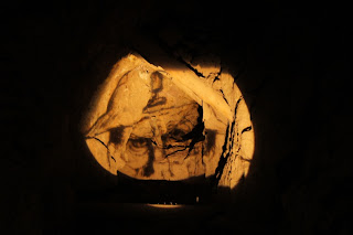
The underground tour took about an hour and was excellent, with lots of history of how the copper was mined here and they have done a good job of making the mine accessible for the public.


It was then back to cars as we were heading off to do the Heritage 4WD track at Merna Mora station and we had to start it by 12:30 pm to allow enough time to see everything. It cost $45. On the way to the station we stopped a couple of times for photos as the scenery on the west side of Wilpena Pound was just as good as we had seen on the east.


We got to the station with a couple of minutes to spare and paid for the track and our camping for the evening, then headed off to explore the station. There were old ruins as well as part of the old Ghan railway line (several culverts) and the cement making kilns they used for the railway line was  still in reasonable shape. Then off to the other side of the highway but still on the property and the 4WD'ing got a bit harder with several hill climbs up to lookouts, that required a slow but steady approach over the slippery shale and dirt track. The views were pretty good again and the following photos don't nearly do justice to it. We also got out and walked about 400-500 metres up a hill to a memorial site for one of the locals. The view was sensational, the gasping for breath not so.


Then it was back to the camping area beside a very dry creek where we set up camp for the evening, cooking dinner on the campfire. A few drinks and sleep seemed like a very good idea.

We were up relatively early and got packed up and under way by 8am. Back on the highway we headed south to Hawker were we needed to pick up some gear left by a friend of Brett's when he had collided with an emu while riding his motorbike a week or so ago. (I think this proves there is an emu conspiracy to take over the roads and eventually rule the world or it could be that they are just exceptionally stupid animals.) We refuelled, collected the gear and had a great bacon and egg sandwich at the general store before once again hitting the road south. We wanted to get over to at least Wentworth and the start of the Darling RIver run by the end of the day. This led to a relatively boring day of driving down through Peterborough, onto Morgan and then Renmark before we crossed into Victoria. We turned off for Wentworth just before Mildura. In Wentworth we checked with the Tourist info people that the Darling River run was open and found that you could go the whole distance by swapping from side to side on the river. Then a quick refuel and we were off north before turning off the main road to travel the west side of the river. Unfortunately for most of the trip we only saw glimpses of the river as we travelled. We found a great campsite just south of Pooncarie, down beside the river, so we set up camp for the evening and settled down around the campfire. There was very good 3G reception there, so we were both sitting around the campfire with our iPads checking email, Facebook, news of the outside world, etc.


Once again the next morning we were up relatively early, packed up and under way by around 8'ish. Pooncarie actually had some access points to the river but as we had been camping on the river the previous night we didn't go and explore. This time we were on the east side of the river and heading to Menindee. Once again a bit of a boring drive without seeing the river much. At Menindee we went to explore the national park a bit but most of the roads in it were closed due to water so we didn't get to see much. 


We left Menindee to the north and travelled up the west side of the river again to Wilcania, where we had a quick look and continued on, transferring to the eastern side of the river for the trip to Tilpa, Louth and Bourke. This section was good road but we hardly saw the river at all so ended up being bit of a boring drive. Stopped briefly in Bourke at the Tourist info place and found a niceish free camping spot out the north side of the town and right on the river. They were already a few grey nomad caravans there but we managed to get a good spot down close to the river. The only downside of this camping spot was the hum a generator in the background presumably pumping water for the orchids but it didn't really cause any worries with getting to sleep. All up the Darling River run was a bit of a disappointment as the river wasn't all that accessible. 

Thursday, 6 September 2012

Flinders Ranges Trip August 2010 - Day 5 and 6.

It was a very chilly morning, Brett's external thermometer was showing -1.6, so we slept in a bit until the sun warmed things up a bit. We packed up and headed off to do the Skytrek 4WD track at about 9 am. The original Skytrek was based  on the Willow Springs station and  on The Bunkers Conservation Reserve, however since earlier in the year The Bunkers section could no longer be accessed. The Willow Springs people created new tracks on their property to cover the loss of the previous track. It is relatively expensive $65 and you need a key to get through a locked gate but as we spent most of the day driving, looking around and taking photos, I think it was worth it. There are historical sights, both aboriginal and later settlers, natural views and of course a bit of 4WD'ing. Although, the 4WD'ing is not too tough with the roughest parts belonging to the newly formed tracks which are still bedding in. The following photos don't really do justice to some of the scenic views available on this track.


We finished the track about 4 pm and headed off to Wilpena Pound campground to camp for the night. After setting up camp we walked back to the shop and for a bit of fresh fruit and vege shopping since we weren't allowed to take fruit and veg into SA. While at the shop the freezer full of Magnums managed to override my better judgement and force me to have one. Yum. On the walk back to our campsite about 40-50 school girls arrived in several buses and luckily they weren't camping anywhere near us, although they did do a bit of a night walk around the campsite, we could hear them or more particularly their giggling as they passed our campfire. There was a good 3G connection so we could catch up with email, facebook, etc., however it was going to be a cold night again so we went to bed relatively early to keep warm.

The next morning was a chilly one as well and we took awhile to get up and get going, however we were packed and ready to go for a walk at 9 am. We chose the Wangara Lookout walk which was about 7.5 km. Most of it was fine however the last half a kilometre was pretty steep and uphill. The views from the lookout were superb. 


When we got back to the cars we had a shower and headed off to Blinman via the back roads. Along the way we found a few steep hills just off to the side of the main road and driving up them gave us a great view of the surrounding area. We got to Blinman but didn't stay long as we were going to come back the following morning to go on the underground mine tour, so we headed off to find a camp site in the Parachilna Gorge once again via the back roads. There were a large number of great campsites along the creek but unfortunately there was a pretty strong wind blowing and it took awhile to find a spot that had a bit of protection. The wind died down a bit while we set up camp and had dinner around the campfire but it started to pick up again later in the night. We made sure that the fire was well and truly out before we went to bed and not long after a freak gust of wind tried to flatten my little tent, luckily it sprung back up and suffered no damage. Brett didn't seem to notice it in the penthouse on top of his car.

Wednesday, 5 September 2012

Flinders Ranges Trip August 2010 - Day 3 and 4.

Once again we got up as the sun came up and packed up after a coffee. We continued south but the road tended to be several kilometres from the dog fence now, although we took a few trips down some side roads to the border and saw some ruins on the other side of the border but couldn't go across to take any photos. Then after slowing down around a corner I ended up with an emu trying to force me off the road. It ran into the side of the car, luckily the damage wasn't too bad, for either me or the emu (it looked confused for a bit and then ran off). The Paj ended up with some damage to the front drivers side panel between the door and the wheel. The main downside was that the drivers door would only a foot or two which made it much harder getting in and out to open the roughly 40 million gates we passed through on the rest of this trip (OK maybe I'm exaggerating a bit, but not much).


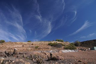
Continuing south we passed through Silverton, stopping briefly for a photo.


Then it was on to Broken Hill to refuel and grab a bite to eat. Followed by one of the most boring drives in the world, across the Barrier Highway before stopping at Yunta where Brett topped up his fuel and I probably should have done the same, as with his new larger fuel tank he could almost have outlasted the lightly sipping Paj and I never would have heard the end of it. Then it was north from Yunta along the road to Arkaroola. We stopped at the ruins of Waukaringa for a few photos and ended up spending a fair bit of time looking over the remains of a gold mine situated on top a nearby hill and trying to work out what a long hand built stone tunnel was for.


On our maps we spotted an abandoned farm a bit further north and off the main road, so we went to investigate. It was pretty modern and probably only abandoned within the last 10-20 years. The maps showed another track leading out to the main road, so we started to explore and found it hadn't been used in many years but we ended up finding a great campsite of the beaten track. We set up camp shielded from the wind and gathered some wood for a campfire and settled in for the night.

The next morning we gave the sun a chance to warm things up a bit before we climbed out of bed as it had got a little chilly overnight. The disused road we were on continued to get worse and at times we ended up going across country as the washouts were too deep to drive through. We found another old set of ruins which looked like they had been used by miners or farmers. We found a metal stamp that we didn't identify until later on when we went for a tour of the mine at Blinman, it was part of the packaging for some explosives. Then finally we were back on the main road and we headed to the Flinders Ranges via  Erudina and Martin's Well. Along the way we stopped at Pugilist Hill lookout for a few photos.


Then it was onto the main road through the Ranges where we stopped at Rawnsley Lookout before heading off to have a look at Sacred Canyon.


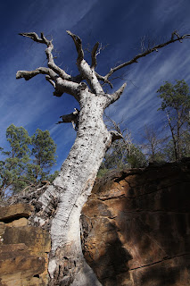
Then as we still had plenty of daylight left we stopped at the Cazneaux tree -


and we continued on to the scenic loop around the national park seeing Bunyeroo and Brachhina Gorges.


We then went and checked into the Willow Springs station as we wanted to do the Skytrek 4WD track the following day. We set up camp at a great spot and went for a drive Stokes Hill lookout to the sun set over Wilpena Pound. Then it was back to camp for a great hot shower and some dinner and drinks around the campfire. Brett helped me experiment with taking photos using just moon light.